|
WWW ChemTools
|
- Ion Formula by Mol. Weight
- Isotope Pattern Calculator
- Mass Loss Calculator
- Periodic e-Table
|
|
|
WWW BioTools
|
- EMBL Peptide Search - protein ID from peptide mass and sequence data
- FindMod - post-translational modifications by peptide mass
- GlycanMass - oligosaccharide mass from structure
- GlycoMod - oligosaccharide structures from mass
- GlycoSuiteDB - search database with oligosaccharide mass
- Javascript Protein Digest - peptide digest masses
- Javascipt Fragment Ion Generator for peptides
- Mascot Search - peptide mass and sequence tools
- Mowse - protein identification from peptide MS data
- Protein Prospector - mass spectra interpretation tools
- PROWL - identification of proteins from MS data
|
|

|
|
past feature
|
|
|
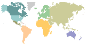
Viking's Travels
Scientists have used mass spectrometry to carbon date a parchment map of the New World that predates Christopher Columbus' voyage by about 50 years. A Smithsonian Institution study, published in the July issue of the journal Radiocarbon concludes that the map's parchment was produced around 1434. This predates Christopher Columbus' voyage by about 50 years, adding to evidence that Vikings reached the New World before he did.
Jacqueline Olin and other researchers from the Smithsonian used a thin strip of parchment taken from the map to date it by radiocarbon dating with accelerator mass spectrometry.
The authenticity of the map has been debated for some time when a benefactor donated it to Yale University. Yale has not taken a position on whether the map is authentic. The map depicts a representation of the world including the north Atlantic coast of North America. It includes text in medieval Latin and a legend that describes how a Norseman, Leif Eiriksson found a new land called Vinland around the year 1000 A.D. Other evidence of such a voyage exists from traces of a Viking settlement excavated in Newfoundland, Canada in the 1960s.
|
|
|
|
MS Journals
|
|
- European Mass Spectrom.
- Intl. J. of Mass Spectrom.
- J. American Society of MS
- J. Mass Spectrometry
- J. MS Society of Japan
- Mass Spectrometry Reviews
- Rapid Communications in MS
|
|
|
Science Journals
|
|
- Analyst
- Analytical Chemistry
- Nature
- New Scientist
- Science
- Scientific American
|
|
|
Literature Search
|
- Beilstein Abstracts
- ChemWeb
- Current Contents - ISI
- PubMed - NCBI
- PubScience - DOE
|
|
|